搜索结果: 1-2 共查到“国际动态 测绘科学技术 Changes”相关记录2条 . 查询时间(0.296 秒)

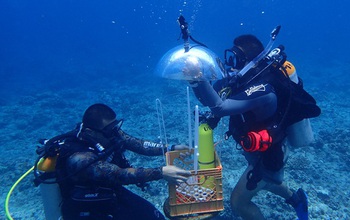
In Guam, researchers developed a method for mapping underwater areas that is transforming how oceanographers observe the seafloor. Data from global positioning satellites are the primary method for ma...
Portland State laser mapping project shows landscape changes in Antarctica
Portland State laser mapping project landscape changes Antarctica
2017/9/5
Portland State University researchers and the National Science Foundation (NSF) have publically released high-resolution maps of the McMurdo Dry Valleys, a globally unique Antarctic polar desert.The P...


