
�������: 1-15 ���鵽��ң����Ϣ���� GIS����ؼ�¼105�� . ��ѯʱ��(0.152 ��)
�ɶ�������ѧ�����ѧѧԺ��ȫ����ѧ��ң����GISӦ�ü��ܴ���һ�Ƚ���ͼ��
�ɶ�������ѧ�����ѧѧԺ ��ѧ�� ң����GIS Ӧ�ü��ܴ��� һ�Ƚ�
2019/1/12
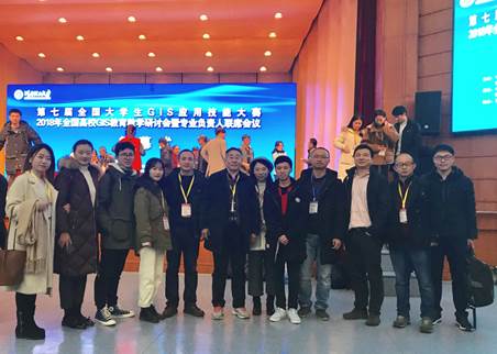
2018��11��30��-12��2�գ����߽�ȫ����ѧ��GISӦ�ü��ܴ�����ȫ����УGIS������ѧ���ֻ���רҵ��������ϯ�����ں���������ѧ���С���У��������ʦָ����ѧ����ٻ�������ա���������ĺ�ƾ����ʵ��רҵ���ܻ�һ�Ƚ���������ʦ������ָ����ʦ���ƺš�����չ�ֳ�����Уң�п�ѧ�뼼����������Ϣ��ѧרҵѧ���������⡢��������������������Ҳ��������˳ɶ�������ѧ���ڡ����ѧ��������ң����GIS������ɫר...
LANDSLIDE HAZARD ZONATION MAPPING OF CHAMOLI LANDSLIDES IN REMOTE SENSING AND GIS ENVIRONMENT
Landslides Chamoli Remote Sensing Hazard, Himalaya
2019/2/27
Landslides are very common problem in hilly terrain. Chamoli region of Himalaya is highest sensitive zone of the landslide hazards. The purpose of Chamoli landslide study, to observe the important ter...
MULTITEMPORAL ANALYSIS OF FOREST COVER CHANGE USING REMOTE SENSING AND GIS OF KANHA TIGER RESERVE, CENTRAL INDIA
Forest LULC Livelihood Climate Change Adaptation
2019/2/27
Forest ecosystems play a key role in global ecological balance and provide a variety of tangible and intangible ecosystem services that support the livelihoods of rural poor. In addition to the anthro...
REMOTE SENSING & GIS INTEGRATION FOR MONITORING THE AREAS AFFECTED BY FOREST FIRES: A CASE STUDY IN IZMIR, TURKEY
Remote Sensing Forest Fire Burn Indexes Classification Sentinel Landsat DEM
2018/5/8
A forest fire is stated as an ecological disaster whether it is man-made or caused naturally. İzmir is one of the regions where forest fires are most intensified in Turkey. The study area located...
The UN Open GIS Initiative is to identify and develop, under UN guidance, an Open Source GIS bundle that meets the requirements of UN operations, taking full advantage of the expertise of mission part...
DYNAMIC MONITORING OF SOIL AND WATER LOSSES USING REMOTE SENSING AND GIS TECHNIQUES:A CASE STUDY OF JIALING RIVER,YANGTZE RIVER,CHINA
Soil and Water Loss Intensity Estimation Dynamic Interpretation Spatial Analysis Uncertainty Quality Control
2016/12/1
Water and soil loss problems are serious in China, especially in the upper and middle reaches of big rivers. This paper dynamically observed water and soil loss in key control regions in Jialing River...
UAV AND GIS BASED TOOL FOR COLLECTION AND PROPAGATION OF SEEDS MATERIAL�CFIRST RESULTS
Seed Stands Forests DSS UAV
2016/11/30
Seed management carried out by The State Forests National Forest Holding is an integral part of rational forest management. Seed collection takes place mainly from stands belonging to first category o...
FULLY AUTOMATED GIS-BASED INDIVIDUAL TREE CROWN DELINEATION BASED ON CURVATURE VALUES FROM A LIDAR DERIVED CANOPY HEIGHT MODEL IN A CONIFEROUS PLANTATION
Crown Delineation Canopy Height Model (CHM) Local Maxima Curvature Slope Thiessen Polygons
2016/11/30
The generation of high resolution canopy height model (CHM) from LiDAR makes it possible to delineate individual tree crown by means of a fully-automated method using the CHM��s curvature through its s...
ESTIMATION OF PHOSPHORUS EMISSIONS IN THE UPPER IGUAZU BASIN (BRAZIL) USING GIS AND THE MORE MODEL
Phosphorus Emissions Water Pollution MoRE Model Basin Management
2016/11/30
Pollution emissions into the drainage basin have direct impact on surface water quality. These emissions result from human activities that turn into pollution loads when they reach the water bodies, a...
REFINEMENT METHOD FOR RESIDENTIAL AREA REVISION USING REMOTE SENSING IMAGE AND GIS DATA IN EARTHQUAKE RISK ASSESSMENT
Earthquake Disaster Risk Assessment Residential Area Revision Remote Sensing
2016/11/30
This paper proposes an automatic approach for residential areas revision by means of analysing the correlation between the residential area and the topographic and geographical factors. The approach c...
USING REMOTE SENSING AND GIS TECHNIQUES TO DETECT CHANGES TO THE PRINCE ALFRED HAMLET CONSERVATION AREA IN THE WESTERN CAPE,SOUTH AFRICA
Change Detection Remote Sensing Biodiversity Wetland Conservation
2016/11/23
Understanding and identifying the spatial-temporal changes in the natural environment is crucial for monitoring and evaluating conservation efforts, as well as understanding the impact of human activi...
Automatic classification of remote sensing data for GIS database revision
Automatic classification remote sensing data GIS database revision
2016/5/23
Geographic information systems (GIS) are dependent on accurate and up-to-date data sets. The manual revision of GIS data is very cost and time consuming. On the other hand more and more high resolutio...
GIS-RELATED WEB ENGINEERING AS TOPIC AND TOOL IN E-LEARNING
e-learning geoinformatics web engineering web services earth viewers AJAX SVG
2016/1/29
In the last few years, map viewers like Google Maps, Microsoft Live Search Maps and Open Street Map as well as virtual earth viewers like Google Earth and Microsoft Virtual Earth had an important impa...
DATABASE COLLECTION FOR LAND COVER VALIDATION AND MONITORING ON REMOTE SENSING/GIS IN WEST PART OF MONGOLIA
Situ data ISPRS Regional network
2016/1/3
The Research Addresses Two Major objectives related to land cover monitoring in Mongolia. First, we collected of in situ land cover variables by ground truth surveys and then implemented different lan...
URBAN SOCIAL VULNERABILITY ASSESSMENT USING OBJECT-ORIENTED ANALYSIS OF REMOTE SENSING AND GIS DATA.A CASE STUDY FOR TEGUCIGALPA,HONDURAS
Social vulnerability assessment Remote sensing Object-oriented analysis Proxy variables Tegucigalpa
2016/1/3
This paper deals with the assessment of social vulnerability (SV) as a critical component of comprehensive disaster risk assessment. Indicators for SV relate to aspects on different scales. Individual...
�й��о����������а�-��
- ���ڼ���...
�й�ѧ���ڿ����а�-��
- ���ڼ���...
�����ѧ���л������а�-��
- ���ڼ���...
�й���ѧ���а�-��
- ���ڼ���...
�ˡ���-ƪ
- ���ڼ���...
�Ρ���-ƪ
- ���ڼ���...
��������-ƪ
- ���ڼ���...
�������� -ƪ
- ���ڼ���...
֪ʶҪ��-ƪ
- ���ڼ���...
���ʶ�̬-ƪ
- ���ڼ���...
��������-ƪ
- ���ڼ���...
ѧ��ָ��-ƪ
- ���ڼ���...
ѧ��վ��-ƪ
- ���ڼ���...