
�������: 1-15 ���鵽����Ӱ������ң�м��� GIS����ؼ�¼263�� . ��ѯʱ��(0.419 ��)
�й�ʯ�ʹ�ѧ��������2021��˶ʿ�о��������������ĿGNSS��RS��GISԭ���뷽�����Դ��
�й�ʯ�ʹ�ѧ�������� 2021�� ˶ʿ�о��� ���� �������Ŀ GNSS��RS��GISԭ���뷽�� ���Դ��
2020/10/14
�й�ʯ�ʹ�ѧ��������2021��˶ʿ�о��������������ĿGNSS��RS��GISԭ���뷽�����Դ�١�
�ɶ�������ѧ�����ѧѧԺ��ȫ����ѧ��ң����GISӦ�ü��ܴ���һ�Ƚ���ͼ��
�ɶ�������ѧ�����ѧѧԺ ��ѧ�� ң����GIS Ӧ�ü��ܴ��� һ�Ƚ�
2019/1/12
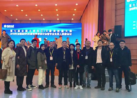
2018��11��30��-12��2�գ����߽�ȫ����ѧ��GISӦ�ü��ܴ�����ȫ����УGIS������ѧ���ֻ���רҵ��������ϯ�����ں���������ѧ���С���У��������ʦָ����ѧ����ٻ�������ա���������ĺ�ƾ����ʵ��רҵ���ܻ�һ�Ƚ���������ʦ������ָ����ʦ���ƺš�����չ�ֳ�����Уң�п�ѧ�뼼����������Ϣ��ѧרҵѧ���������⡢��������������������Ҳ��������˳ɶ�������ѧ���ڡ����ѧ��������ң����GIS������ɫר...
LANDSLIDE HAZARD ZONATION MAPPING OF CHAMOLI LANDSLIDES IN REMOTE SENSING AND GIS ENVIRONMENT
Landslides Chamoli Remote Sensing Hazard, Himalaya
2019/2/27
Landslides are very common problem in hilly terrain. Chamoli region of Himalaya is highest sensitive zone of the landslide hazards. The purpose of Chamoli landslide study, to observe the important ter...
MULTITEMPORAL ANALYSIS OF FOREST COVER CHANGE USING REMOTE SENSING AND GIS OF KANHA TIGER RESERVE, CENTRAL INDIA
Forest LULC Livelihood Climate Change Adaptation
2019/2/27
Forest ecosystems play a key role in global ecological balance and provide a variety of tangible and intangible ecosystem services that support the livelihoods of rural poor. In addition to the anthro...
ROOFING ASSESSMENT FOR ROOFTOP RAINWATER HARVESTING ADOPTION USING REMOTE SENSING AND GIS APPROACH
Remote sensing GIS, rooftop rainwater harvesting geospatial environment
2018/11/8
Rooftop rainwater harvesting refers to the collection and storage of water from rooftops whereby the quality of harvested rainwater depend on the types of roof and the environmental conditions. This s...
EVALUATION OF RESOURCES CARRYING CAPACITY IN CHINA BASED ON REMOTE SENSING AND GIS
carrying capacity CCRR model modification remote sensing
2018/5/15
This paper accurately extracted the information of arable land, grassland (wetland), forest land, water area and construction land, based on 1 : 250000 basic geographic information data. I...
REMOTE SENSING & GIS INTEGRATION FOR MONITORING THE AREAS AFFECTED BY FOREST FIRES: A CASE STUDY IN IZMIR, TURKEY
Remote Sensing Forest Fire Burn Indexes Classification Sentinel Landsat DEM
2018/5/8
A forest fire is stated as an ecological disaster whether it is man-made or caused naturally. İzmir is one of the regions where forest fires are most intensified in Turkey. The study area located...
INTEGRATED USE OF REMOTE SENSING, GIS AND GPS TECHNOLOGY FOR MONITORING THE ENVIRONMENTAL PROBLEM OF SHYAMNAGAR
Environmental disaster Shrimp Agriculture Remote Sensing GIS GPS Classifications
2017/7/12
Cultivation of shrimp mostly in unplanned way has been considered as one of the major environmental disasters of Shamnagar. Villagers surrounding the rivers are mainly involved with fish (shrimp) cult...
CHALLENGES AND OPPORTUNITIES: ONE STOP PROCESSING OF AUTOMATIC LARGE-SCALE BASE MAP PRODUCTION USING AIRBORNE LIDAR DATA WITHIN GIS ENVIRONMENT. CASE STUDY: MAKASSAR CITY, INDONESIA
Automation LiDAR Processing Base Map Production GIS Accuracy Assessment
2017/7/12
LiDAR data acquisition is recognized as one of the fastest solutions to provide basis data for large-scale topographical base maps worldwide. Automatic LiDAR processing is believed one possible scheme...
MAIN FEATURES OF A 3D GIS FOR A MONUMENTAL COMPLEX WITH AN HISTORICAL-CULTURAL RELEVANCE
3D model 3D GIS Cultural Heritage BIM technologies
2017/6/20
The last achievements of technologies in geomatics especially in survey and restitution of 3D models (UAV/drones and laser scanner technologies) generated new procedures and higher standards of qualit...
FROM EXCAVATIONS TO WEB: A GIS FOR ARCHAEOLOGY
Excavation GIS intra-site archaeological dig photogrammetric reconstruction stratigraphical unit documentation
2017/6/20
The study and the protection of Cultural Heritage in recent years have undergone a revolution about the search tools and the reference disciplines. The technological approach to the problem of the col...
The UN Open GIS Initiative is to identify and develop, under UN guidance, an Open Source GIS bundle that meets the requirements of UN operations, taking full advantage of the expertise of mission part...
DYNAMIC MONITORING OF SOIL AND WATER LOSSES USING REMOTE SENSING AND GIS TECHNIQUES:A CASE STUDY OF JIALING RIVER,YANGTZE RIVER,CHINA
Soil and Water Loss Intensity Estimation Dynamic Interpretation Spatial Analysis Uncertainty Quality Control
2016/12/1
Water and soil loss problems are serious in China, especially in the upper and middle reaches of big rivers. This paper dynamically observed water and soil loss in key control regions in Jialing River...
UAV AND GIS BASED TOOL FOR COLLECTION AND PROPAGATION OF SEEDS MATERIAL�CFIRST RESULTS
Seed Stands Forests DSS UAV
2016/11/30
Seed management carried out by The State Forests National Forest Holding is an integral part of rational forest management. Seed collection takes place mainly from stands belonging to first category o...
�й��о����������а�-��
- ���ڼ���...
�й�ѧ���ڿ����а�-��
- ���ڼ���...
�����ѧ���л������а�-��
- ���ڼ���...
�й���ѧ���а�-��
- ���ڼ���...
�ˡ���-ƪ
- ���ڼ���...
�Ρ���-ƪ
- ���ڼ���...
��������-ƪ
- ���ڼ���...
�������� -ƪ
- ���ڼ���...
֪ʶҪ��-ƪ
- ���ڼ���...
���ʶ�̬-ƪ
- ���ڼ���...
��������-ƪ
- ���ڼ���...
ѧ��ָ��-ƪ
- ���ڼ���...
ѧ��վ��-ƪ
- ���ڼ���...