
搜索结果: 1-7 共查到“海洋科学 Images”相关记录7条 . 查询时间(0.159 秒)
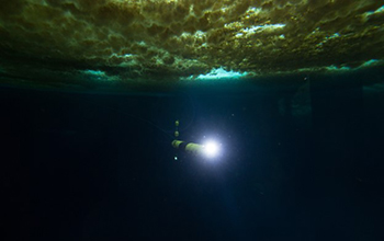
Robotic underwater vehicle snaps first images of seafloor beneath Antarctica's Thwaites Glacier(图)
Robotic underwater vehicle snaps first images seafloor beneath Antarctica Thwaites Glacier
2020/2/20
During the first study of the ocean floor beneath Antarctica’s Thwaites Glacier, scientists took images of the glacier's foundations. Thwaites now accounts for about 4% of global sea level rise, and r...
Signature of Large Aspect Ratio Roll Vortices in Synthetic Aperture Radar Images of Tropical Cyclones
Large Aspect Ratio Roll Vortices Synthetic Aperture Radar Images Tropical Cyclones
2015/7/16
Synthetic aperture radar images of tropical cyclones have been processed into high-resolution surface wind vector fields. Examination of the surface wind divergence and wind stress curl show that wind...
Meteo-Marine Parameters and Their Variability Observed by High Resolution Satellite Radar Images
Meteo-Marine Parameters Variability Observed High Resolution Satellite Radar Images
2015/7/16
New radar satellites image the sea surface with resolutions as high as 1 m. A large spectrum of ocean processes can be estimated using such Earth observation data. These data have been applied to inve...
Some Problems Associated with Wind Drag and Infrared Images of the Sea Surface
Wind Drag Sea Surface Infrared Images
2009/4/2
It is argued that there should be a close connection between fluctuations in infrared images of the sea and fluctuations in wind drag on the sea. The critical regions of wind speed, temperature, and s...
An Inverse Model for Near-Surface Velocity from Infrared Images
Doppler acoustic log Near-Surface Velocity Infrared Images
2009/1/5
An inverse model to infer the near-surface velocity from the heat equation was applied to a series of six infrared satellite images from northern California. The inversion used a two-dimensional nondi...
Based Marine Radar Images
Marine Radar Images X-band marine radar internal waves Strait of Gibraltar
2008/12/27
An X-band marine radar on Windmill Hill, Gibraltar, was used to monitor the propagation of internal waves in the Strait of Gibraltar during March, April, and June 1986. Surface roughness features of t...
Internal Waves in the Strait of Messina Studied by a Numerical Model and Synthetic Aperture Radar Images from the ERS 1/2 Satellites
synthetic aperture radar Numerical Model ERS
2008/11/18
A new numerical two-layer model is presented, which describes the generation of internal tidal bores and their disintegration into internal solitary waves in the Strait of Messina. This model is used ...