
搜索结果: 61-75 共查到“测绘科学技术 GIS”相关记录1083条 . 查询时间(0.14 秒)
THE STUDY OF INSURANCE PREMIUM RATE GIS MAPPING CONSIDERING THE STORM AND FLOOD HAZARD RISKS
Storm and Flood Insurance Map GIS Insurance Rate
2016/11/30
Recently, the number of natural disaster occurrence is increasing because of abnormal changes of weather in Korea. In Korea the storm and flood insurance system is in effect to prevent these natural d...
PROCESSING UAV AND LIDAR POINT CLOUDS IN GRASS GIS
3D rasters decimation sampling binning LAS PDAL PCL Kinect
2016/11/24
Today’s methods of acquiring Earth surface data, namely lidar and unmanned aerial vehicle (UAV) imagery, non-selectively collect or generate large amounts of points. Point clouds from different source...
USING REMOTE SENSING AND GIS TECHNIQUES TO DETECT CHANGES TO THE PRINCE ALFRED HAMLET CONSERVATION AREA IN THE WESTERN CAPE,SOUTH AFRICA
Change Detection Remote Sensing Biodiversity Wetland Conservation
2016/11/23
Understanding and identifying the spatial-temporal changes in the natural environment is crucial for monitoring and evaluating conservation efforts, as well as understanding the impact of human activi...
THE POTENTIAL OF GIS AS A MANAGEMENT TOOL FOR AVENUE TREES POPULATION IN SMALL COMMUNITIES; A CASE STUDY OF IDI-SHIN COMMUNITY, IBADAN, NIGERIA
GIS Avenue Trees Urban Forest
2016/11/15
This study demonstrates the potentials of Geographic Information System (GIS) as a management tool for avenue trees (Street trees) populations in small communities (using Idi-Ishin community, Ibadan, ...
ANALYSIS OF JURE LANDSLIDE DAM, SINDHUPALCHOWK USING GIS AND REMOTE SENSING
Landslide Dam GIS Remote Sensing Jure Nepal
2016/11/15
On 2nd August 2014, a rainfall-induced massive landslide hit Jure village, Sindhupalchowk killing 156 people at a distance of 70 km North-East of Kathmandu, Nepal. The landslide was a typical slope fa...
LOST IN THE CLOUD - NEW CHALLENGES FOR TEACHING GIS
Cloud based GIS open source open data teaching learning
2016/11/15
As cloud based services move towards becoming the dominant paradigm in many areas of information technology, GIS has also moved into ‘the Cloud’, creating a new opportunities for professionals and stu...
DESIGNING AND MODELLING COAST MANAGEMENT GIS FOR BOSPHORUS
Web Based GIS Bosphorus Georeferencing DTM Digitizing
2016/11/8
Web based geographic information systems (GIS) has great potential based on developments in internet and web technology. Web based GIS is a network based tool that takes advantage of internet with vis...
A DISCUSSION ABOUT EFFECTIVE WAYS OF BASIC RESIDENT REGISTER ON GIS
GIS Basic Resident Register Address Dictionary Geocoding Address Points
2016/11/8
In Japan, each municipality keeps a database of every resident’s name, address, gender and date of birth called the Basic Resident Register.
昆明理工大学2016年硕士研究生招生入学考试GIS原理及应用试题。
昆明理工大学2017年硕士研究生入学考试GIS原理及应用考试大纲。
中国矿业大学(北京)2017年硕士研究生入学自命题GIS基础考试大纲。
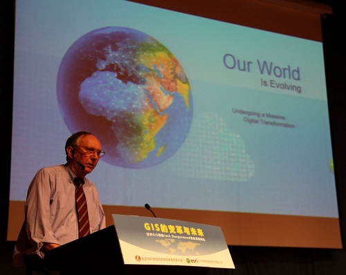
“GIS的变革与未来”高端论坛在北京举行(图)
GIS的变革与未来 高端论坛 北京
2016/9/18
2016年9月9日,应中国科学院地理科学与资源研究所资源与环境信息系统国家重点实验室邀请,Esri全球总裁Jack Dangermond在北京国家会议中心以GIS的发展现状、应用模式和存在形态的变化趋势以及未来发展方向为主题作了专题报告,并与特邀嘉宾和与会人员进行了深入交流与对话。本次论坛由中国科学院地理科学与资源研究所资源与环境信息系统国家重点实验室陆锋研究员主持,中国科学院地理科学与资源研究所...
Earth Resources and Environmental Remote Sensing/GIS Applications
Earth Resources Environmental Remote Sensing
2016/7/28
Long range land surveillance is a critical need in numerous military and civilian security applications, such as threat detection, terrain mapping and disaster prevention. A key technology for land su...
MOBILE GIS: A TOOL FOR INFORMAL SETTLEMENT OCCUPANCY AUDIT TO IMPROVE INTEGRATED HUMAN SETTLEMENT IMPLEMENTATION IN EKURHULENI, SOUTH AFRICA
Mobile GIS occupancy audit informal settlements
2016/7/8
Upgrading and relocating people in informal settlements requires consistent commitment, good strategies and systems so as to improve the lives of those who live in them. In South Africa, in order to a...
This paper presents an endeavour of integration of GIS (Geographical Information System) and BIM (Building Information Modelling) for indoor geovisual analytics. The merits of two types of technologie...