
搜索结果: 1-7 共查到“测绘科学技术 California”相关记录7条 . 查询时间(0.218 秒)
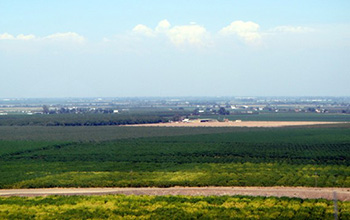
Researchers use satellite imaging to map groundwater use in California's Central Valley(图)
satellite imaging map groundwater California Central Valley
2020/10/16
Researchers at the University of California, San Diego report a new way to improve groundwater monitoring by using a remote sensing technology, known as InSAR (interferometric synthetic aper...
Using InSAR for Seismotectonic Observations the Mw 6.0 Parkfield Earthquake, 2004, California
SAR Geodesy Earthquakes Hazards Surveying
2015/12/18
Across an earthquake cycle stress builds up along faults. The understanding of how stress builds up and when and where it is released is crucial in the understanding of the earthquake cycle. Remote se...
Evaluation of use of remote-sensing imagery in refinement of geologic mapping for seismic hazard zoning in northern los angeles county, California
Remote Sensing Seismic Hazard Zoning Geologic Mapping
2015/8/21
The California Seismic Hazards Mapping Act of 1990 directs the California Geological Survey (CGS) to delineate seismic hazard
zones of required investigation for earthquake-induced ground failures - ...
Persistent Pelagic Habitats in the Baja California to Bering Sea (B2B) Ecoregion
Bering Sea marine management strategies
2015/7/29
The Baja California to Bering Sea (B2B) Marine Conservation Initiative seeks to establish a network of Marine Protected Areas within the Exclusive Economic Zones of the NAFTAcountries- Canada, Mexico,...
autONOmOuS OceaN meaSuremeNtS iN the califOrNia curreNt ecOSyStem
California Current Ecosystem OceaN
2015/7/16
Event-scale phenomena, of limited temporal duration or restricted
spatial extent, often play a disproportionately large role in ecological processes
occurring in the ocean water column. Nutrient a...

Professor Thomas H. Heaton,Division of Geological and Planetary Sciences at California Institute of Technology(图)
Professor Thomas H. Heaton Division of Geological and Planetary Sciences at California Institute of Technology
2014/4/8
Thomas H. Heaton Professor of Engineering Seismology B.S., Indiana University, 1972; Ph.D., Caltech, 1978. Visiting Associate in Geophysics, 1980-91; Faculty Associate, 1991-95; Lecturer in Geophysics...
Finite source modelling of magmatic unrest in Socorro, New Mexico, and Long Valley, California
geodesy inflation Long Valley magma sill Socorro
2014/4/9
We investigate surface deformation associated with currently active crustal magma bodies in Socorro, New Mexico, and Long Valley, California, USA. We invert available geodetic data from these location...
