搜索结果: 1-15 共查到“理学 airborne”相关记录159条 . 查询时间(0.233 秒)

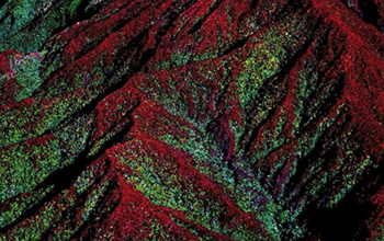
Airborne science discovers complex geomorphic controls on Bornean forests(图)
Airborne science complex geomorphic controls Bornean forests
2020/6/5
Tropical forests contain some of the most biodiverse and dynamic ecosystems in the world.The influence of precipitation, temperature, and soils is especially noticeable when comparing the towering tre...
FEATURE RELEVANCE ASSESSMENT OF MULTISPECTRAL AIRBORNE LIDAR DATA FOR TREE SPECIES CLASSIFICATION
Multispectral Lidar 3D point clouds Intensity Tree Species Classification Feature Analysis
2018/5/11
The presented experiment investigates the potential of Multispectral Laser Scanning (MLS) point clouds for single tree species classification. The basic idea is to simulate a MLS sensor by combining t...
A THRESHOLD-FREE FILTERING ALGORITHM FOR AIRBORNE LIDAR POINT CLOUDS BASED ON EXPECTATION-MAXIMIZATION
Airborne LiDAR Point clouds Filtering Ground points Expectation-maximization Intensity
2018/5/14
Filtering is a key step for most applications of airborne LiDAR point clouds. Although lots of filtering algorithms have been put forward in recent years, most of them suffer from parameters setting o...
ALTERATION MINERALS EXTRACTION USING AIRBORNE HYPERSPECTRAL DATA CASI AND SASI IN WUYI METALLOGENIC BELT, CHINA
Alteration Minerals Airborne Hyperspectral Wuyi Metallogenic Belt Spectral Feature MTMF CASI and SASI
2018/5/14
Hydrothermal alteration is an important content in the study of epithermal deposit, and its deep part is often accompanied by porphyry mineralization. The objective of research is to mapping the alter...
MASSIVE LINKING OF PS-INSAR DEFORMATIONS TO A NATIONAL AIRBORNE LASER POINT CLOUD
Airborne Laser Scanning PS-InSAR geolocation deformation monitoring local surface reconstruction data fusion
2018/6/5
Build on soft soil, close to sea level the Netherlands is at high risk for the effects of subsidence and deformation. Interferometric Synthetic Aperture Radar (InSAR) is successfully used to monitor t...
2018年SPIE地面和机载望远镜会议(SPIE Ground-based and Airborne Telescopes VII)
2018年 SPIE 地面和机载望远镜 会议
2017/11/27
This conference is the latest in the series on Ground Based and Airborne Telescopes, where progress in the field continues at an exciting pace. The next generation of extremely large telescopes is und...
2018年SPIE地面和空中天文仪器会议(SPIE Ground-based and Airborne Instrumentation for Astronomy VII)
2018年 SPIE 地面和空中天文仪器 会议
2017/11/27
Instrument development for large ground-based observatories is continuing apace, with second and third generation instruments on the 8-10m class telescopes yielding a rich scientific harvest. In paral...
GRAVITY ANOMALY ASSESSMENT USING GGMS AND AIRBORNE GRAVITY DATA TOWARDS BATHYMETRY ESTIMATION
Satellite gravity mission gravity anomaly and Global Geopotential Model
2016/10/14
The Earth’s potential information is important for exploration of the Earth’s gravity field. The techniques of measuring the Earth’s gravity using the terrestrial and ship borne technique are time con...
MARINE GEOID UNDULATION ASSESSMENT OVER SOUTH CHINA SEA USING GLOBAL GEOPOTENTIAL MODELS AND AIRBORNE GRAVITY DATA
Global Geopotential Model Geoid Undulations Airborne Gravity Gravity Missions
2016/10/14
Global geopotential models (GGMs) are vital in computing global geoid undulations heights. Based on the ellipsoidal height by Global Navigation Satellite System (GNSS) observations, the accurate ortho...
ESTIMATION OF AERODYNAMIC ROUGHNESS AND ZERO PLANE DISPLACEMENT USING MEDIUM DENSITY OF AIRBORNE LIDAR DATA
Airborne LiDAR Aerodynamic Roughness Length Zero Plane Displacement Forest
2016/10/14
This paper presents a framework to estimate aerodynamic roughness over specific height (zo/H) and zero plane displacement (d/H) over various landscapes in Kelantan State using airborne LiDAR data. The...
ORIENTATION AND PROCESSING OF AIRBORNE LASER SCANNING DATA (OPALS) - CONCEPT AND FIRST RESULTS OF A COMPREHENSIVE ALS SOFTWARE
LIDAR ALS processing software automatic workfl ow data administration
2016/2/29
Since the mid-1990s, the Institute of Photogrammetry and Remote Sensing (I.P.F.) is engaged in Airborne Laser Scanning (ALS) in
research and development. Scientific contributions have been made...
AN INTERACTIVE TOOL FOR 3D OBJECT EXTRACTION USING AIRBORNE LASERSCANNING DATA AND ORTHOIMAGES
Airborne Laserscanning Orthoimages 3D Object Extraction
2015/9/28
Light Detection And Ranging (LiDAR) provides reliable and detailed 3D data of the earth surface. This data combined with digital
Orthoimages can be used to create detailed 3D object models that are ...
Temperature distribution analysis of July 2001 Mt. Etna eruption observed by the airborne hyperspectral sensor MIVIS
remote-sensing volcano monitoring thermal infrared dual-band technique
2015/9/17
On 17th and 18th July 2001, several fractures opened on Mt. Etna southern flank generating different lava flows
spreading both in Valle del Bove and towards Nicolosi. On 29th July the image spectrome...
Development of a measurement platformon a light airplane and analysis of airborne measurementsin the atmospheric boundary layer
light airplane measurements atmospheric dynamics kinematic GPS positioning Kriging
2015/9/16
In the present paper we provide an overview of a long term research project aimed at setting up a suitable platform
for measurements in the atmospheric boundary layer on a light airplane along with s...
Aerosol optical thickness of Mt. Etna volcanic plume retrieved by means of the Airborne Multispectral Imaging Spectrometer (MIVIS)
aerosol optical thickness volcanic plume MIVIS DEM radiative transfer model 6S inversion technique
2015/9/16
Within the framework of the European MVRRS project (Mitigation of Volcanic Risk by Remote Sensing
Techniques), in June 1997 an airborne campaign was organised on Mt. Etna to study different character...

