
�������: 1-15 ���鵽����ѧ Resolution����ؼ�¼407�� . ��ѯʱ��(0.122 ��)
Academy of Mathematics and Systems Science, CAS Colloquia & Seminars��Weak multisymplectic spectral integrators with a resolution of Gibbs phenomenon
����˹���� �ֱ��� �������� ������
2023/4/28
We will report our recent work on weak multisymplectic spectral integrators for a wide range of nonsmooth Hamiltonian partial differential equations, which appear in quite a few physical applications ...
Academy of Mathematics and Systems Science, CAS Colloquia & Seminars��Defocusing NLS equation with nonzero background: Soliton resolution in soliton region
���㱳�� ɢ��NLS���� �������� ���ӷֱ���
2023/5/5
Consider to the Cauchy problem of the defocusing NLS equation with a nonzero background. With the Dbar generalization of the nonlinear steepest descent method to compute the leading order approximatio...
Highest-resolution measurements of asteroid surface temperatures ever obtained from Earth
asteroid belt solar system surface temperature
2021/8/9
A close examination of the millimeter-wavelength emissions from the asteroid Psyche, which NASA intends to visit in 2026, has produced the first temperature map of the object, providing new insight in...
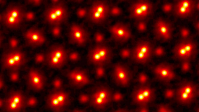
In 2018, Cornell researchers built a high-powered detector that, in combination with an algorithm-driven process called ptychography, set a world record by tripling the resolution of a state-of-the-ar...

High-resolution ocean model looks at sea turtles' lost years��ͼ��
High-resolution ocean model looks sea turtles lost years
2021/3/26
A detailed global ocean model simulation by scientists at the National Center for Atmospheric Research and other institutions has given scientists insights into where baby sea turtles may go...
2021��������ʱ�ز㼰��ʯ��Դ�������ֻᣨInternational Conference on Palaeobiology, High Resolution Stratigraphy and Fossil Energy ��
2021�� ������ ��ʱ�ز� ��ʯ��Դ �������ֻ�
2021/2/26
To celebrate the 70th Anniversary of Nanjing Institute of Geology and Palaeontology, Chinese Academy of Sciences (NIGPAS), the International Conference on Palaeobiology, High Resolution Stra...
HIGH-RESOLUTION ENHANCED PRODUCT BASED ON SMAP ACTIVE-PASSIVE APPROACH USING SENTINEL 1A AND 1B SAR DATA
soil moisture microwave remote sensing active-passive algorithm SMAP Sentinel-1A -1B
2019/2/27
SMAP project released a new enhanced high-resolution (3km) soil moisture active-passive product. This product is obtained by combining the SMAP radiometer data and the Sentinel-1A and -1B Synthetic Ap...
INFORMATION CONTENT ANALYSIS FROM VERY HIGH RESOLUTION OPTICAL SPACE IMAGERY FOR UPDATING SPATIAL DATABASE
Information Content Topographing Mapping GIS Remote Sensing VHR Images
2018/11/9
High resolution satellite images started with IKONOS imagery. After the launch of the very high resolution IKONOS in the 1990s, a new generation of commercial Earth-imaging satellites have pioneered a...
RESOLUTION ENHANCEMENT ALGORITHM FOR SPACEBORN SAR BASED ON HANNING FUNCTION WEIGHTED SIDELOBE SUPPRESSION
SAR image Sidelobe suppression Hunning function
2018/5/14
Resolution and sidelobe are mutual restrict for SAR image. Usually sidelobe suppression is based on resolution reduction. This paper provide a method for resolution enchancement using sidelobe opposit...
HIGH RESOLUTION SAR IMAGING EMPLOYING GEOMETRIC FEATURES FOR EXTRACTING SEISMIC DAMAGE OF BUILDINGS
SAR Imaging Geometry Feature Building Seismic Damage Extraction
2018/5/11
Synthetic Aperture Radar (SAR) image is relatively easy to acquire but difficult for interpretation. This paper probes how to identify seismic damage of building using geometric features of SAR. The S...
ALGORITHM AND APPLICATION OF GCP-INDEPENDENT BLOCK ADJUSTMENT FOR SUPER LARGE-SCALE DOMESTIC HIGH RESOLUTION OPTICAL SATELLITE IMAGERY
Rational Function Model (RFM) Virtual Control Points Least-squares Block Adjustment Alternating Direction Method Geometric Constraints of Horizontal and Vertical
2018/5/15
The accurate positioning of optical satellite image without control is the precondition for remote sensing application and small/medium scale mapping in large abroad areas or with large-scale images. ...
APPLICABILITY OF VARIOUS INTERPOLATION APPROACHES FOR HIGH RESOLUTION SPATIAL MAPPING OF CLIMATE DATA IN KOREA
Climate Change Interpolation IDW Cokriging Kriging Precipitation Temperature
2018/5/14
The purpose of this study is to create a new dataset of spatially interpolated monthly climate data for South Korea at high spatial resolution (approximately 30m) by performing various spatio-statisti...
URBAN SHANTY TOWN RECOGNITION BASED ON HIGH-RESOLUTION REMOTE SENSING IMAGES AND NATIONAL GEOGRAPHICAL MONITORING FEATURES �C A CASE STUDY OF NANNING CITY
Gray-level co-occurrence matrix shanty town residential suitability nearest neighbour
2018/5/14
Urban shanty towns are communities that has contiguous old and dilapidated houses with more than 2000 square meters built-up area or more than 50 households. This study makes attempts to extract shant...
FLASH FLOOD MAPPING FOR MOUNTAIN STREAMS USING HIGH-RESOLUTION ALOS-2 DATA
ALOS-2 Capacity building Flood detection Valley floodplain
2018/4/18
This paper introduces a practical way to improve the risk management capacity and resilience of communities by utilizing a prompt flash flood map produced from very high spatial resolution ALOS-2 data...
Super Resolution Imaging Helps Determine a Stem Cell��s Future
Super Resolution Imaging Stem Cell Future
2017/3/14
Scientists at Rutgers and other universities have created a new way to identify the state and fate of stem cells earlier than previously possible.Understanding a stem cell��s fate �C the type...
�й��о����������а�-��
- ���ڼ���...
�й�ѧ���ڿ����а�-��
- ���ڼ���...
�����ѧ���л������а�-��
- ���ڼ���...
�й���ѧ���а�-��
- ���ڼ���...
�ˡ���-ƪ
- ���ڼ���...
�Ρ���-ƪ
- ���ڼ���...
��������-ƪ
- ���ڼ���...
�������� -ƪ
- ���ڼ���...
֪ʶҪ��-ƪ
- ���ڼ���...
���ʶ�̬-ƪ
- ���ڼ���...
��������-ƪ
- ���ڼ���...
ѧ��ָ��-ƪ
- ���ڼ���...
ѧ��վ��-ƪ
- ���ڼ���...